Products
- Details
![]()
![]()

Geodemographic systems consist of a powerful set of tools for comprehending the behavior of people residing in different areas. Such a system, gives the ability to understand the profile of people that buy a certain product or service or prefer a certain lifestyle. The geodemographic segmentation includes the classification of small geographic areas in relatively homogeneous zones. It is based on demographic and lifestyle data.
Insider is a geodemographic system that has been developed for Attica, in a postal code areal unit, utilizing GIS Technology and Computational Intelligence methods. System applications can be grouped in four categories:

Geodemographic Analysis
For more information, please read the Leaflet.
Satellite Cartography is an evolution in printed Cartography. As a base, it utilizes satellite imagery or orthophotos in combination with other contextual information to meet the requirements for each mapping (e.g. roads, landmarks, place-names, etc.). Our company is the first and only company with such products in Greece. Please contact us for more information.

Satellite Cartography Products
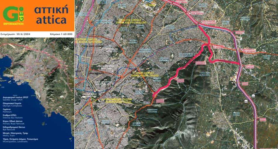
Utilizing Satellite Cartography: Map of Attica, Greece

Utilizing Satellite Cartography: Map of Mykonos, Greece
For more information, please read the Leaflet.
Map stands are intended for public and private sector bodies for improving accessibility, facilitating orientation and movement of the public, better informing visitors regarding places of interest, etc. Our company undertakes the construction, provision and installation of signs (stands), displaying satellite or conventional maps.
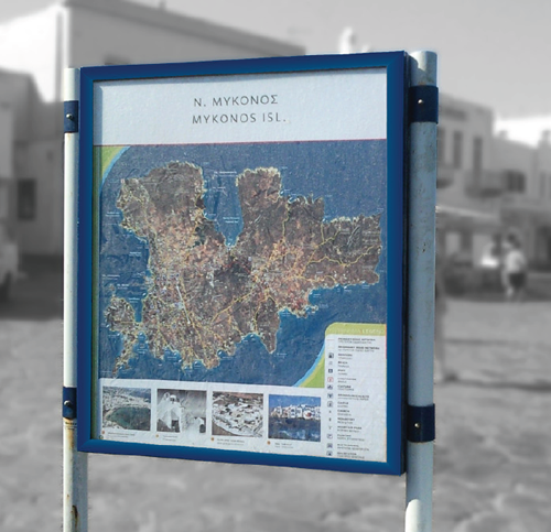
Map Stand in Mykonos
For more information, please read the Leaflet.
Geodemographic systems consist of a powerful set of tools for comprehending the behavior of people residing in different areas. Such a system, gives the ability to understand the profile of people that buy a certain product or service or prefer a certain lifestyle. The geodemographic segmentation includes the classification of small geographic areas in relatively homogeneous zones. It is based on demographic and lifestyle data.
Insider is a geodemographic system that has been developed for Attica, in a postal code areal unit, utilizing GIS Technology and Computational Intelligence methods. System applications can be grouped in four categories:
Geodemographic Analysis
For more information, please read the Leaflet.
Satellite Cartography is an evolution in printed Cartography. As a base, it utilizes satellite imagery or orthophotos in combination with other contextual information to meet the requirements for each mapping (e.g. roads, landmarks, place-names, etc.). Our company is the first and only company with such products in Greece. Please contact us for more information.
Satellite Cartography Products
Utilizing Satellite Cartography: Map of Attica, Greece
Utilizing Satellite Cartography: Map of Mykonos, Greece
For more information, please read the Leaflet.
Map stands are intended for public and private sector bodies for improving accessibility, facilitating orientation and movement of the public, better informing visitors regarding places of interest, etc. Our company undertakes the construction, provision and installation of signs (stands), displaying satellite or conventional maps.
Map Stand in Mykonos
For more information, please read the Leaflet.